
Hiking routes on active volcanoes offer something few landscapes can match: the chance to walk on ground that’s still breathing.
These five volcanoes—spread across Africa, Asia, and the Americas—share one quality that sets them apart. Their trails remain, for the most part, untouched by mass tourism. Their craters, their geology, and the conditions they demand make them destinations for people looking for something more than a summit.
1- Nyiragongo, Democratic Republic of Congo: Sleeping Above the World’s Largest Lava Lake
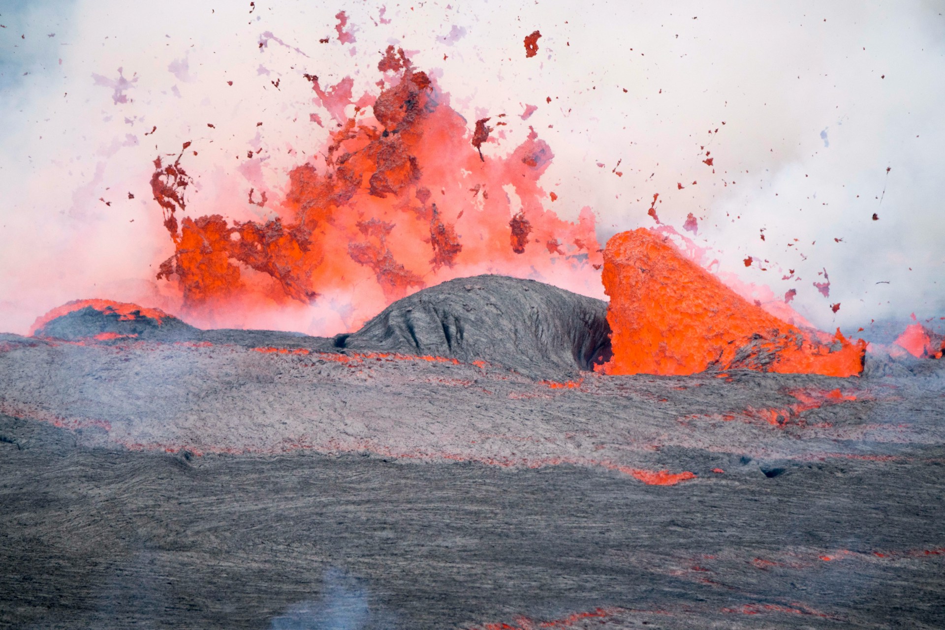
Some volcanoes impress through their size or their history. Nyiragongo’s claim is the permanent lava lake—nearly a mile and a quarter across—that sits inside its crater. At night, seen from the summit, that lake turns the sky red. It is the largest on the planet—and it is active.
The volcano rises to 11,385 feet in Virunga National Park, in the eastern Democratic Republic of Congo, about 12 miles from the city of Goma.
The route begins at the Kibati ranger post, at 6,135 feet, and climbs 4 miles through five distinct sections.
The first passes through dense forest, where rangers point out chimpanzees and colobus monkeys in the canopy above.
Then the landscape shifts abruptly. The trees disappear and the trail crosses fields of solidified lava from previous eruptions, the ground cracked by fissures that still vent sulfurous steam. The final stretch climbs 985 feet in a steep push to the crater rim.
The ascent takes between four and six hours, but the full experience unfolds over two days.
You climb in the afternoon, spend the night in the summit shelters at 11,385 feet, and descend the following morning at dawn—when the lava lake, which burns in the darkness with an almost indescribable intensity, begins to give way to the first light. For many visitors, that transition is the moment.
Nyiragongo’s lava has an unusually low silica content and can flow at 60 miles per hour when the volcano erupts. In 1977, that speed killed hundreds of people in less than 20 minutes. The volcano’s history is as much a part of the landscape as the rock itself.
Visiting requires a permit from the Institut Congolais pour la Conservation de la Nature (ICCN), at an approximate cost of $300. The security situation in the region is variable—all groups are escorted by armed rangers—and should be assessed carefully before planning any trip.
2- Ol Doinyo Lengai, Tanzania: Climbing the Strangest Volcano on Earth by Night
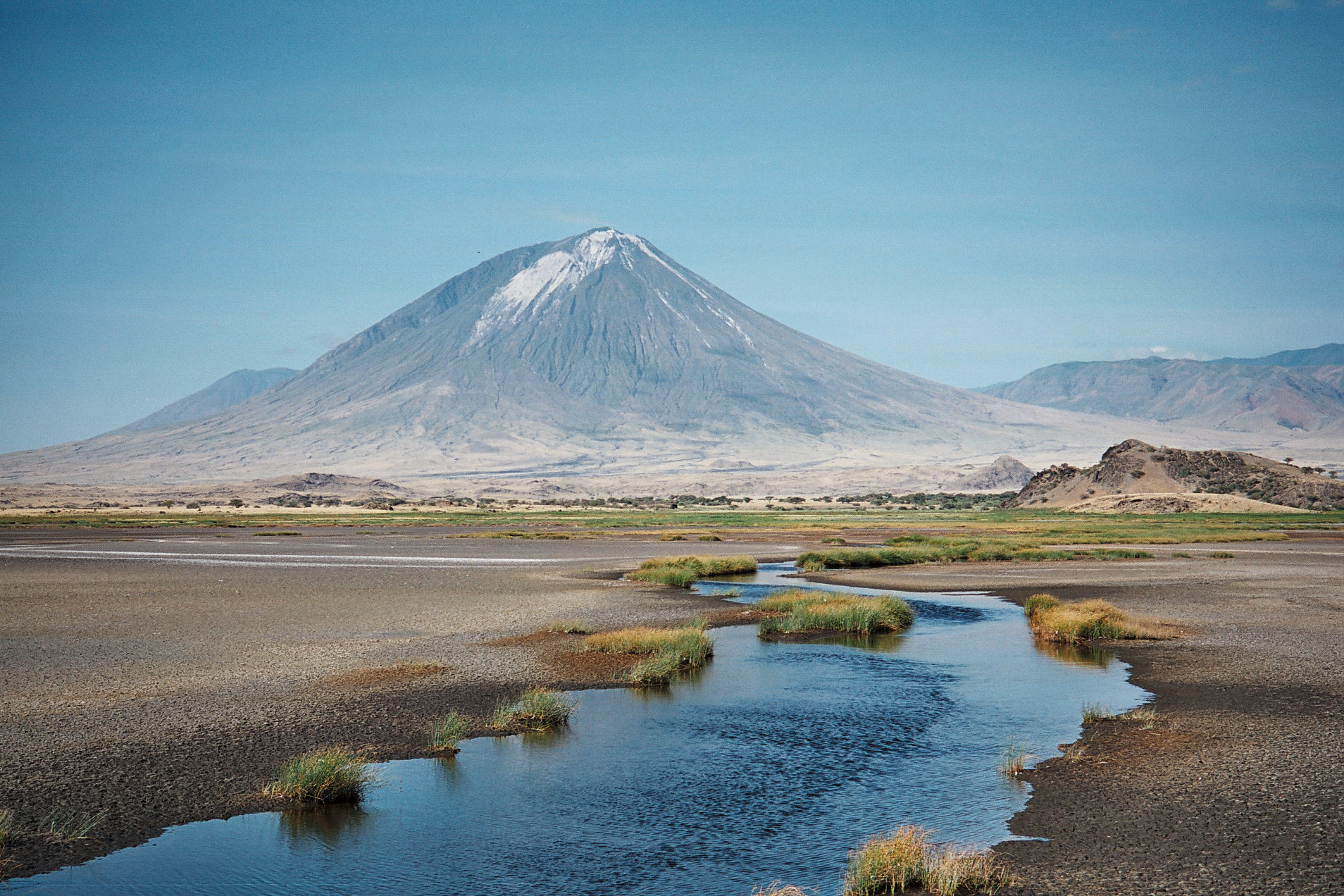
From a distance, Ol Doinyo Lengai looks like a conventional volcanic cone—perfectly symmetrical, rising above the Rift Valley plains, with Lake Natron spread below and pink flamingos nesting along its shores.
Up close, it is something else entirely. It produces a type of lava found nowhere else on Earth: natrocarbonatite, silicon-free, which flows almost like water, glows in muted orange tones at night, and turns white on contact with moisture.
In daylight, it looks like cooled black oil. In darkness, it looks like something that defies any known category.
The route climbs 3.4 miles in a nearly straight line from the base, at 2,625 feet, to the crater rim at 9,718 feet.
The elevation gain exceeds 6,900 feet, with an average gradient of around 45 degrees and near-vertical stretches near the summit where loose ash forces climbers to use their hands. The dropout rate here is higher than on Kilimanjaro, a volcano twice as tall and far better known.
The ascent begins at night—departing around midnight—to avoid temperatures at the base that can exceed 104 degrees Fahrenheit, and to reach the summit at sunrise.
The descent—which many find harder than the climb, given how treacherous the loose ash becomes underfoot—happens in daylight.
The reward at the crater, with Lake Natron spread out below and Kilimanjaro visible on the horizon on clear days, justifies the hours of darkness. This is not a route for everyone, but the experience is hard to match.
The volcano lies about 75 miles northwest of Arusha. A four-wheel-drive vehicle is required to reach the area, and a local Maasai guide is necessary for the ascent. The best seasons are the dry months: January through February and June through October.
3- Kawah Ijen, Indonesia: Blue Fire at Midnight on the World’s Most Acidic Lake
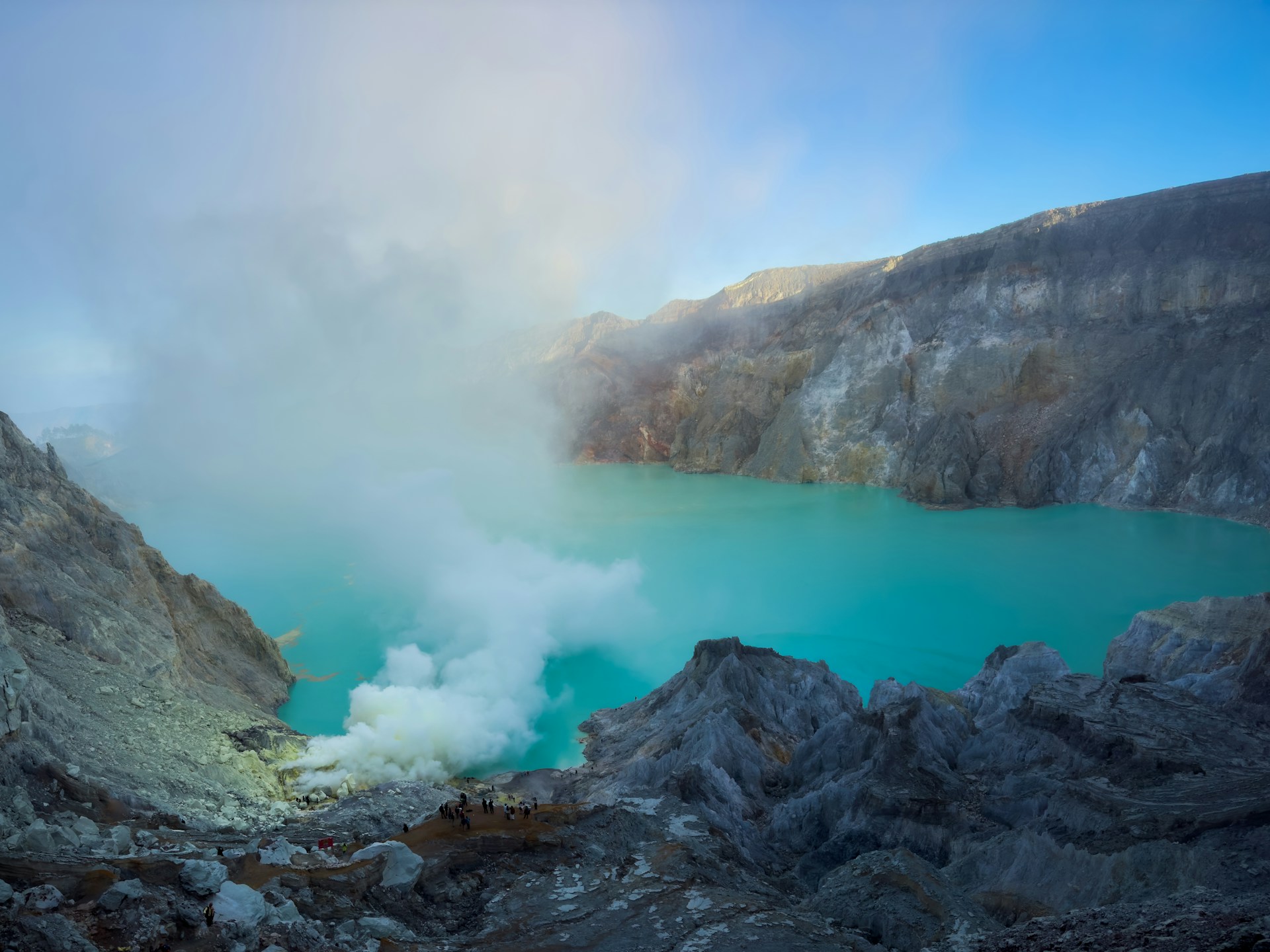
Kawah Ijen holds the largest sulfuric acid lake on the planet.
Nothing lives in it—its pH hovers near zero and its color shifts from turquoise to emerald green depending on sulfur concentration.
Anyone who fell in wouldn’t last long. The contrast between that visual beauty and what it represents is part of what makes this volcano so hard to forget.
The route begins at the Paltuding base camp, on the eastern tip of Java, at 5,905 feet, and climbs for two to three hours to the crater rim at 7,828 feet.
The trail is compacted earth, steep in several sections, with sulfurous gases intensifying as you gain altitude. Those who descend into the crater interior—an additional 45 minutes of downclimbing—need a respirator.
Sulfur miners who have worked here for generations carry loads of up to 200 pounds in bamboo baskets. They make that same descent every day, without protection, for wages that come nowhere near reflecting the effort.
Beyond that story, the phenomenon that makes Kawah Ijen singular is the blue fire. When sulfurous gas ignites at temperatures reaching 1,112 degrees Fahrenheit, electric-blue flames pour from the crater’s fissures. The sight is surreal.
The flames are only visible in complete darkness, which makes a midnight start the standard approach. Seeing them requires patience, a degree of cold, and a willingness to share the spectacle with miners passing within arm’s reach, their baskets loaded and ready for the descent.
From eastern Java, the volcano is accessible by organized transport from Bali or as part of an East Java itinerary that combines it with Mount Bromo.
4- Volcán Pacaya, Guatemala: Accessible Lava Less Than an Hour From Guatemala City
Guatemala has more than 200 volcanic structures and 37 officially recognized volcanoes—a remarkable number for a relatively small country. None of this is surprising: Guatemala sits squarely on the Pacific Ring of Fire.
Among its many options, Pacaya stands out.
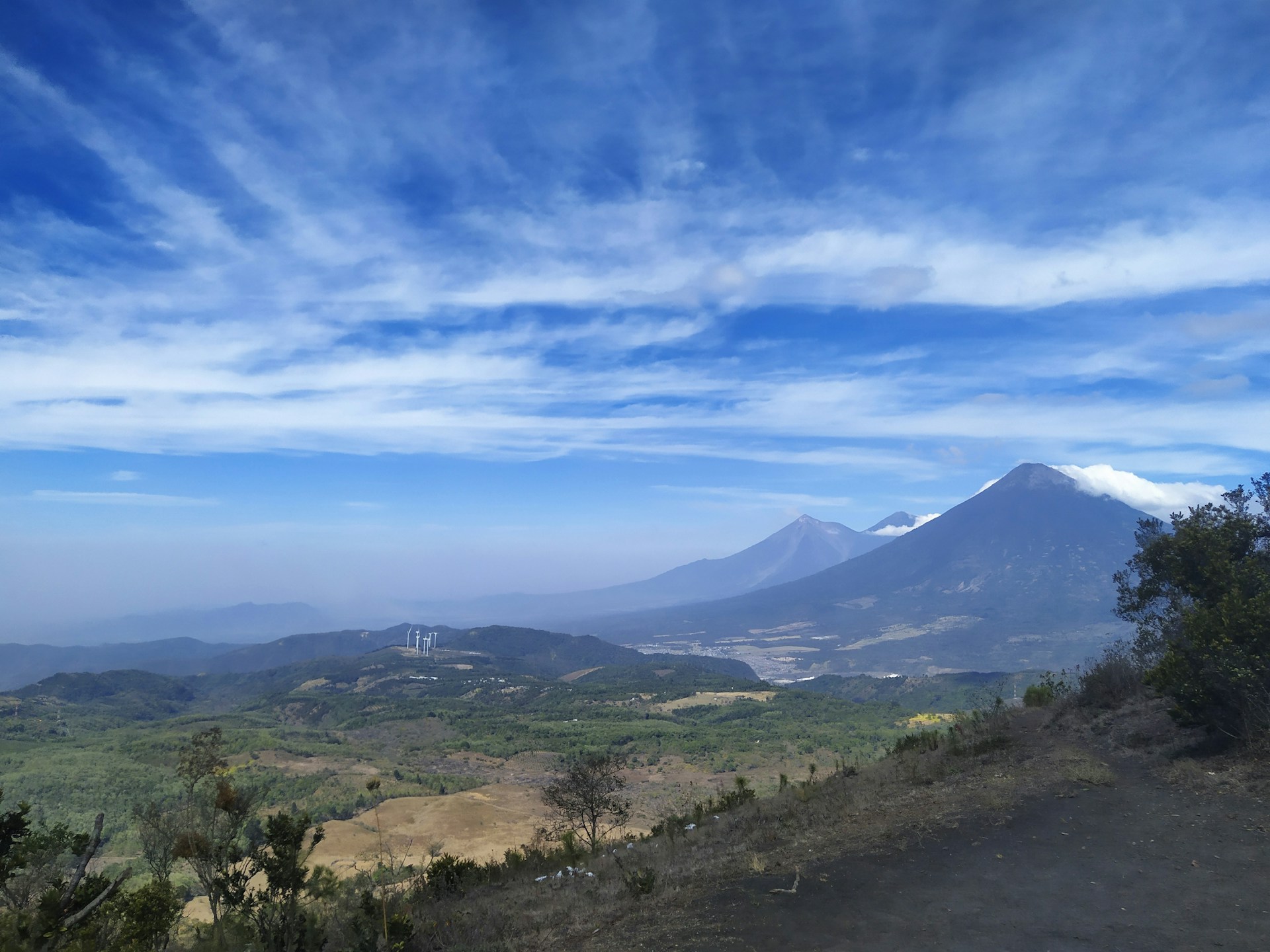
It lacks the reputation of Acatenango and the spectacle of Fuego, but it offers something neither of them can: accessible lava, less than 31 miles from Guatemala City, on a trail that anyone in reasonable physical condition can complete. It is one of the most active volcanoes in Central America and has erupted dozens of times over the past century.
The main route begins at the entrance of San Francisco de Sales, in the department of Escuintla, passing through stretches of forest and across fields of solidified lava from recent eruptions.
The ascent takes about three hours, the descent around two, at a moderate difficulty level. Near the summit, fumaroles radiate heat from just beneath the surface and the rock sounds different underfoot—hollow in places, which gives you a real sense of what lies beneath. During periods of low activity, the most recent lava flows still retain heat under their hardened crust.
From the top, on clear days, you can see the volcanoes Fuego, Agua, Acatenango, and Lake Amatitlán.
Most organized excursions depart from Antigua Guatemala, about 22 miles away, and the cost is low compared to other volcanic destinations worldwide. The best season runs from November through April, during the dry months.
5- Volcán Villarrica, Chile: Glacier, Sulfur, and Ancient Araucarias in the Araucanía
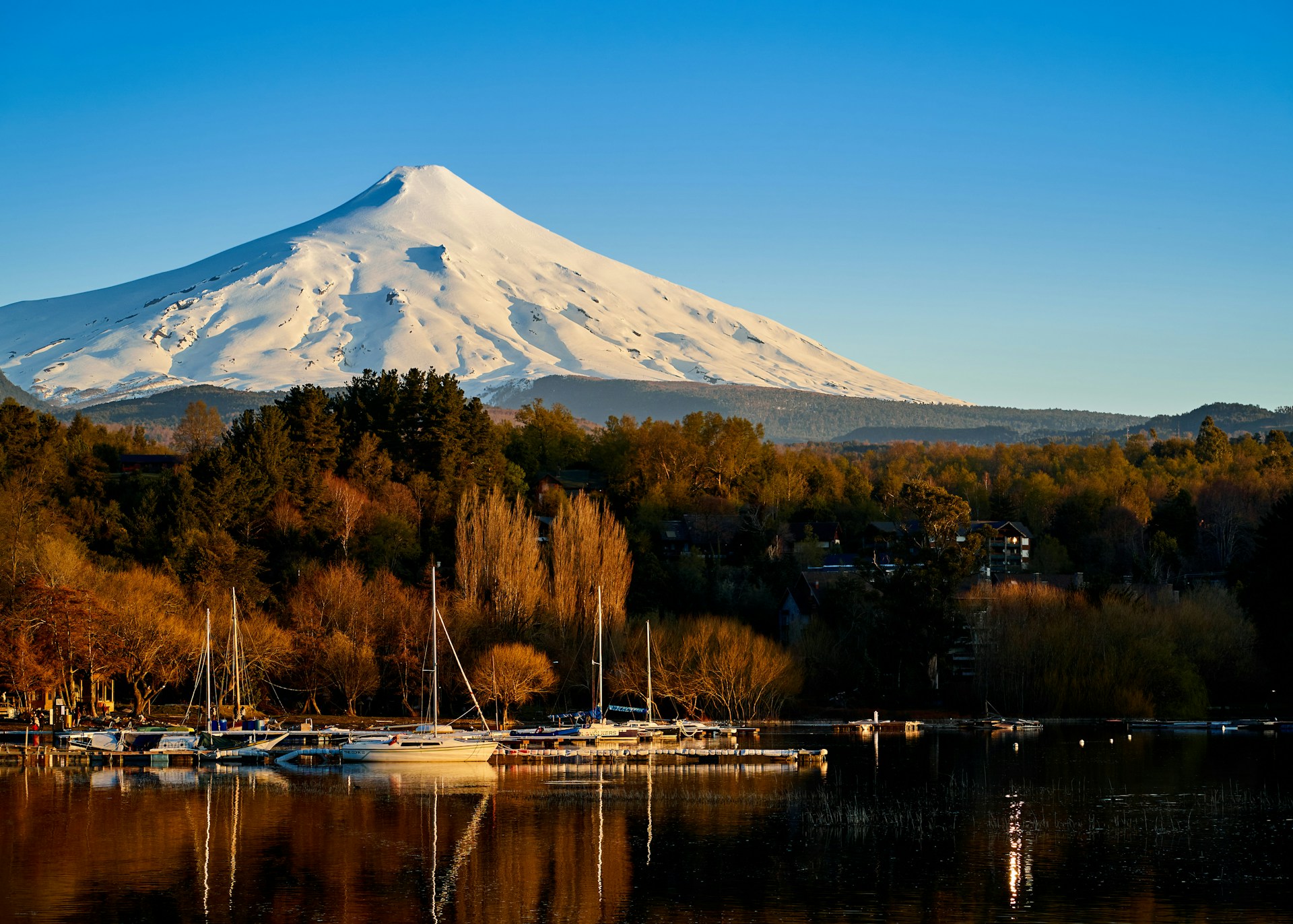
Villarrica erupts. Not now and then, not in the distant past. Its last significant eruption was in March 2015, when it sent columns of lava and ash that were visible from dozens of miles away.
Its crater holds a permanently active lava lake. A hiking route ascends all the way to its rim—on crampons, with an ice axe—making this one of the most direct volcanic experiences on the continent.
The volcano rises to 9,341 feet in the Araucanía region, within Parque Nacional Villarrica, a few miles from the town of Pucón.
The full ascent and descent takes about seven hours and requires a certified guide and technical high-altitude equipment: crampons, ice axe, and helmet.
From 4,593 feet, the route crosses snow and glacier until black volcanic rock takes over and the smell of sulfur fills the air. At the crater rim, with good visibility, the floor of the lava lake is visible below.
The usual climbing season runs from October through May. Even so, weather conditions in the Patagonian Andes change quickly, and the route can be closed without warning when volcanic activity exceeds thresholds set by Chile’s National Geology and Mining Service.
On the volcano’s lower slopes, before the snow begins, araucaria forests—trees that can live more than 1,000 years—give the approach a character that few high-altitude routes can match. Walking among them, knowing what waits above, is part of the experience.
Mount Fuji draws more than 300,000 hikers each summer season. Etna has a cable car running to 8,200 feet. Kilimanjaro supports a trekking industry so well established that its routes have names, bunk-bed huts, and porters who know every step of the way.
These are valid experiences. But the sheer number of people moving through them has changed their nature. Climbing Fuji in August mostly means standing in line on a mountain.
The five volcanoes on this list don’t have that problem—and not because they’re any less interesting.
What sets them apart is not only the absence of crowds. It is that none of them has been tamed to make the experience easier. The routes are demanding, the terrain is hostile to varying degrees, and the effort is real.
For anyone looking for something more than a summit selfie, that is precisely the point.