

Yosemite National Park has more than 800 trails spread across nearly 1,200 square miles of Sierra Nevada wilderness.
That abundance is the park’s biggest draw — and its biggest planning challenge. Choose poorly on a single-day visit, and you may spend half the morning stuck in valley traffic or arrive at a trailhead to find the parking lot closed and the shuttle packed.
What follows is a selection of eight trails that can be completed in a single day, organized by difficulty and divided between the park’s two main areas: Yosemite Valley and Tuolumne Meadows.
What to Know Before You Go
In 2026, the National Park Service discontinued the timed-entry reservation system that had previously governed vehicle access to Yosemite.
No reservation is required to enter the park, though the entrance fee or a valid interagency pass is still required.
Parking in the valley fills quickly, particularly in spring, summer, and on weekends. Arriving before 8 a.m. is the most consistent advice from rangers and experienced visitors alike.
Entrance lanes can back up significantly between 10 a.m. and 2 p.m. For those without a vehicle, the Yosemite Valley Shuttle runs year-round, is free of charge, and connects most valley trailheads.
Easy Trails for a Straightforward Start
The valley floor has the park’s most accessible trails. They are short, nearly flat, and clearly signed — designed for visitors with limited time, families with young children, or anyone who wants to get their bearings before attempting something more demanding.
Do not underestimate them. In under a mile, you can stand at the base of some of the most recognizable waterfalls on earth.
Bridalveil Fall: 0.5 miles round trip | Elevation gain: 80 feet
Bridalveil Fall is the first major waterfall visible from the road as you enter Yosemite Valley.
At 620 feet, it is sometimes mistaken for Yosemite Falls by first-time visitors. The path is short, nearly level, and ends at a viewing platform with a direct line of sight to the base. In spring, the flow is powerful enough that the mist soaks anyone who lingers too close.
The trailhead can be reached from two access points: one from Southside Drive and another from a newer parking area off Wawona Road. In peak season, both fill before midday.
Lower Yosemite Fall: 1-mile loop | Elevation gain: 50 feet
The trail to Lower Yosemite Falls is the most accessible in the park.
The route follows a nearly flat, partially paved path to a bridge with a direct view of the falls as they drop 320 feet to the valley floor. It is open year-round.
Peak flow comes in spring with snowmelt from the Sierra Nevada. By September, in dry years, the falls can shrink to a trickle or disappear entirely.
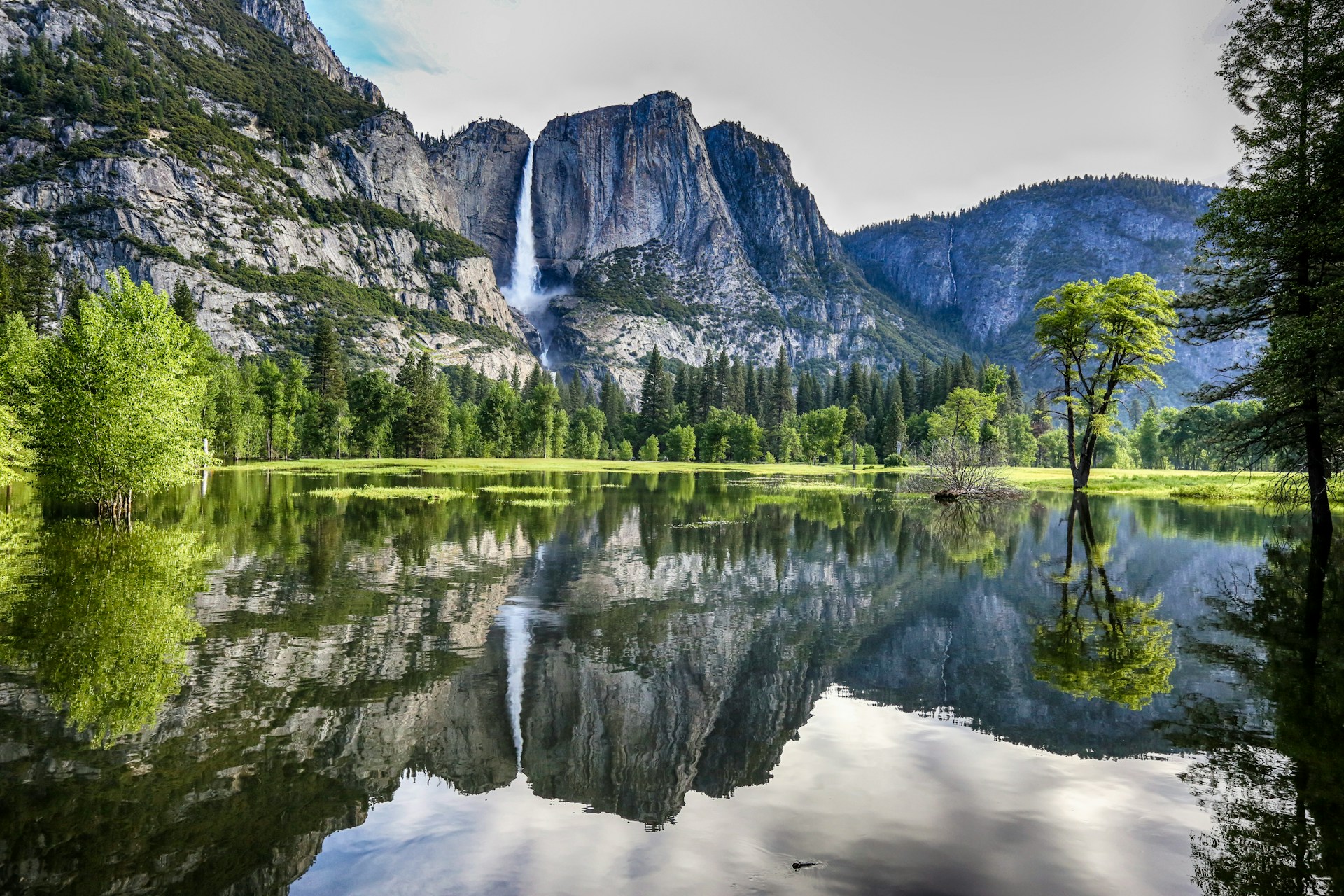
Cook’s Meadow Loop: 1.25-mile loop | Elevation gain: negligible
The Cook’s Meadow loop winds through some of the most quintessential scenery on the valley floor. The path offers unobstructed views of El Capitan, Half Dome, and the Cathedral Rocks.
It is an ideal route for visitors with limited time or young children who want to take in the full scale of the valley before attempting something more strenuous.
Intermediate Trails for More Distance and Better Views
This is where the park starts to show a different side. These trails demand more time and physical fitness, but they offer something the easy routes cannot: elevation, perspective, and a measure of distance from the crowds.
Most depart from the valley or its southern rim and climb high enough to take in the landscape as a whole, rather than in fragments.
Mirror Lake Loop: 5 miles full loop | Elevation gain: 200 feet
The walk to Mirror Lake can be done as a 1.25-mile out-and-back or extended into the full 5-mile loop.
In spring, the lake reflects the north face of Half Dome with a clarity that fully justifies its name. By summer, the water recedes, and what remains is an open meadow. Both are worth seeing, though for entirely different reasons.
The trailhead sits at the eastern end of the valley and is easily reached by park shuttle.
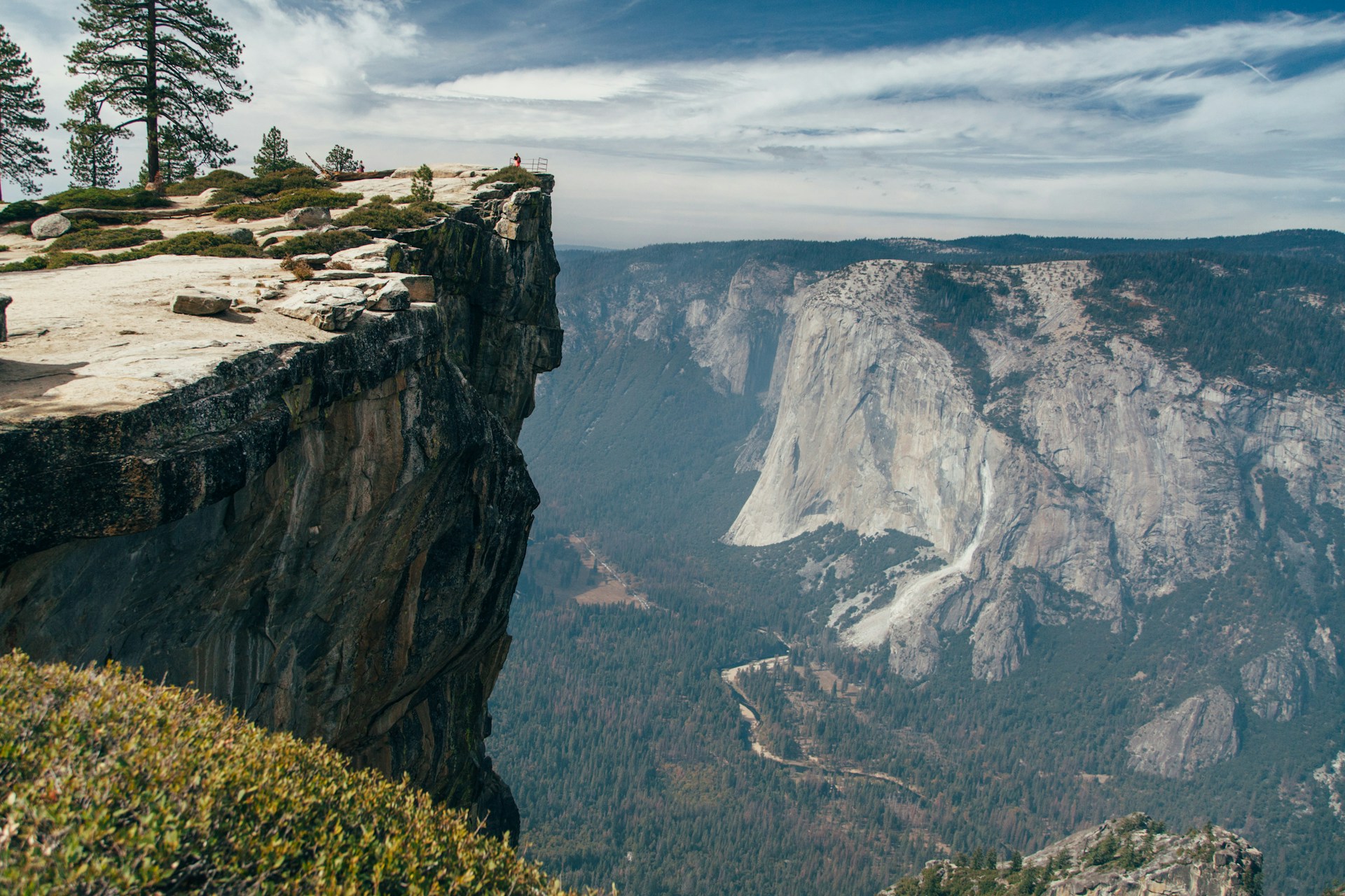
Sentinel Dome and Taft Point: 5.2-mile loop | Elevation gain: 1,105 feet
This loop connects two of the most striking overlooks on the valley’s southern rim.
Sentinel Dome delivers 360-degree views from its rounded granite summit. Taft Point, at the opposite end of the loop, juts out over a sheer drop of nearly 2,000 feet to the valley floor, where the Merced River threads through the trees below.
Near the overlook, fissures — long, narrow cracks in the granite — drop several feet into the rock.
The trailhead is on Glacier Point Road, which is typically closed from mid-November through May.
The loop can be walked in either direction. Many hikers prefer to start at Taft Point and finish at Sentinel Dome, where sunrise or sunset produces a panorama that is difficult to match anywhere else in the park.
Mist Trail to Vernal Fall and Nevada Fall: 2.5 to 8 miles | Elevation gain: 1,000–2,000 feet
The Mist Trail is arguably the most famous in the park.
It climbs steadily from the valley floor toward the Vernal and Nevada Falls.
Hiking to the top of Vernal Fall and back is roughly 3 miles with 1,000 feet of elevation gain. Pushing on to Nevada Fall extends the hike to 5.4 miles round trip, with a total elevation gain of about 2,000 feet.
Past the footbridge at 0.8 miles, the trail splits. The Mist Trail continues straight and steep, climbing stone steps cut into the rock face through the constant spray from Vernal Fall. The John Muir Trail takes a longer, gentler line to the same destination.
For the descent from Nevada Fall, many hikers choose the John Muir Trail to avoid the slick stone steps on the way down.
The trailhead is at Happy Isles. Parking fills before 8 a.m. in peak season; the valley shuttle is the most practical option.
Four Mile Trail to Glacier Point: 9.6 miles round trip | Elevation gain: 3,200 feet
The Four Mile Trail climbs 3,200 feet from the valley floor to Glacier Point, one of the most photographed overlooks in Yosemite.
The elevation gain is distributed between stretches of steep switchbacks and brief reprieves, with views that open progressively toward Half Dome, El Capitan, and Yosemite Falls as you ascend.
There are two ways to complete this trail in a day. The first is to hike up and back the same way.
The second — the better option for those who plan — is to ascend via the Four Mile Trail and descend from Glacier Point along the Panorama Trail to the Mist Trail. That combination covers roughly 12.5 miles with more than 5,000 feet of total elevation gain.
The Four Mile trailhead is on Southside Drive, at Valley Shuttle stop 11.
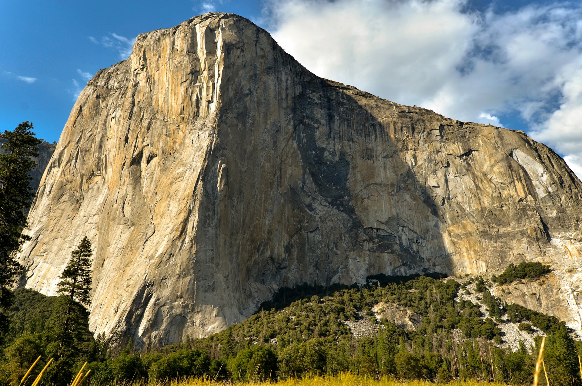
Difficult Trails for Experienced Hikers
These are the routes that define Yosemite in the popular imagination.
They involve long days, elevation gains exceeding 3,000 feet, and — in the case of Half Dome — a permit. Without one, the summit is simply off-limits.
They are not for casual visitors. They demand physical fitness and careful preparation well in advance.
Half Dome: 14–16 miles round trip | Elevation gain: 4,800–5,200 feet
The route to Half Dome covers roughly 14 to 16 miles round trip, with a total elevation gain of around 5,200 feet.
Most hikers who complete it in a single day plan on 10 to 16 hours on the trail.
The final section — the cables — requires a permit. The cables are typically installed from the Friday before Memorial Day through the Tuesday after Columbus Day.
The permit system operates through a pre-season lottery held in March at recreation.gov, with results announced in April. A daily lottery also opens 48 hours before each hiking date.
The pre-season lottery success rate has hovered around 18% in recent years. Applying for weekday dates in September or October improves the odds.
Without a permit, the trail can still be hiked to the sub-dome, where the views over the valley are reward enough for the effort.
Tuolumne Meadows: Yosemite’s High Country
About 56 miles from the valley via Tioga Road, Tuolumne Meadows is a completely different world.
At 8,600 feet, the landscape looks nothing like the valley below. In place of vertical granite walls and thundering waterfalls, there are open meadows, alpine lakes, and rock polished smooth by ancient glaciers.
The crowds are thinner, the air is cooler, and the trails have a distinctly alpine feel.
Tioga Road typically opens in late spring, depending on snowpack, and closes in November. Outside that season, this section of the park is unreachable by vehicle.
Lembert Dome: 1.9 miles round trip | Elevation gain: 850 feet
The trail to Lembert Dome follows a defined path for the first 0.75 miles to a marked junction.
From the summit at 9,450 feet, a panoramic view opens over the Tuolumne Meadows and the Cathedral Range. The final stretch of the ascent crosses open slabs of unmarked granite. Shoes with a solid grip are essential.
The route pairs well with a side trip to Dog Lake, adding roughly half a mile to the total distance.
Cathedral Lakes: 8 miles round trip | Elevation gain: approximately 1,000 feet
Cathedral Lakes are a pair of alpine lakes framed by Cathedral Peak to the east and the summits of Echo and Tresidder to the south — all peaks rising above 10,000 feet.
The trail follows the John Muir Trail from the western edge of Tuolumne Meadows.
The lower lake is the more accessible and more dramatic of the two; it is reached by a quarter-mile spur from the main trail. The full round trip to both lakes takes five to six hours at a moderate pace.
Practical Information
Yosemite charges an entrance fee that varies by vehicle type.
Interagency passes (America the Beautiful) are accepted and provide unlimited access to all national parks for one year.
As of January 2026, the Department of the Interior implemented a new fee structure for non-resident and international visitors. Current pricing should be verified at the NPS website before your visit.
Temperatures in the valley can exceed 95°F in July and August. In Tuolumne, the elevation keeps things cooler, but conditions can shift quickly — afternoon thunderstorms are common in summer.
Extra layers and sufficient water are essential on any trail longer than 3 miles.
Yosemite has a way of exhausting those who try to see everything in a day, and of leaving those who pick just one trail wondering if they missed the point.
It all comes down to planning: knowing which trail matches the time you have, arriving early, and accepting that the park will always offer more than a single day can hold.
That is not a limitation. It is a reason to come back.