

The Nazca geoglyphs lie in the desert of southern Peru — roughly 5,580 feet above sea level, in a landscape that receives barely a tenth of an inch of rain each year — and they have spent more than two millennia waiting to be fully understood. For decades, archaeologists studied them from the air, on foot, by satellite and drone, convinced the catalog was nearly complete. It wasn’t.
A joint study by the Nazca Institute at Yamagata University and IBM Research, published in Proceedings of the National Academy of Sciences (PNAS), documented 303 new figurative geoglyphs in just six months of fieldwork. The discovery nearly doubles the total number of known figures across the Nazca pampa.
The breakthrough was made possible by an artificial intelligence model trained to detect markings in high-resolution aerial imagery across an area exceeding 155 square miles.
303 Figures in Six Months: What Once Took a Century
Archaeologist Masato Sakai has been studying the geoglyphs since 1994. In 2004, he assembled a field team that combined satellite imagery, aerial photography, and drone footage to survey the terrain. The challenge was sheer scale. Surveying the entire pampa on foot — let alone reviewing every high-resolution image — would have taken decades. In 2018, a colleague suggested bringing in artificial intelligence.
The model, developed in collaboration with IBM in New York, was pretrained on a large dataset of aerial images and then applied across the full extent of the Nazca pampa and its surrounding deserts. Its suggestions were reviewed by archaeologists, who identified 1,309 candidate sites. Subsequent field inspections allowed the team to assess those candidates and confirm the new figures.
The system proved to be an extraordinary accelerator. On average, the team evaluated 36 model suggestions for every confirmed figure — a discovery rate 16 times faster than previous methods had achieved.
Two Types of Geoglyphs, Two Distinct Functions
The discovery did more than add to the catalog. It also reshaped our understanding of what the geoglyphs were for, revealing that not all Nazca geoglyphs served the same purpose.
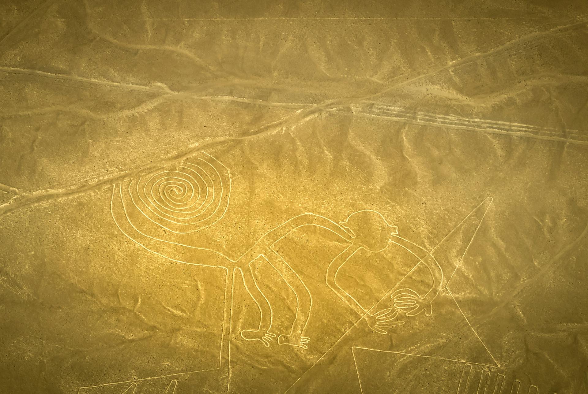
The large linear-type geoglyphs depicted primarily wild animals and were distributed across an elaborate network of linear and trapezoidal forms. The research team concluded they were built and used communally, most likely for ritual activities.
These were the figures that made Nazca famous: the hummingbird, the spider, the monkey with the spiral tail — images visible only from great height.
The relief-type geoglyphs, by contrast, depicted mainly human figures and motifs tied to human activity: domesticated animals, humanoid forms, and decapitated heads. They were typically positioned within sight of the winding paths that crossed the pampa and seem to have been made and viewed by individuals or small groups.
For Sakai, these smaller figures functioned as messages directed at travelers moving along those routes. As he told the Andina news agency, the figures appeared one after another along the paths, as if delivering information in sequence, with each route carrying its own meaning.
What the Geoglyphs Said — and What They May Yet Lose
Among the most striking discoveries were geoglyphs depicting orcas carrying weapons. The image might seem strange at first — until you consider that the same motif appears in the pottery of the same culture. Sakai explained to New Scientist that Nazca-period ceramics depict orcas wielding knives to sever human heads — identifying these creatures as symbols of human sacrifice in local mythology.
That visual vocabulary recurs throughout the new geoglyphs: llamas, fish, plants, humanoid figures, and scenes of apparent decapitation. Each of these figures, formed between 200 B.C. and A.D. 700 by piling up or shifting stones across the desert floor, was meant to be seen by someone on foot, not from the air. But that legacy is now under threat.
Many geoglyphs have been damaged, accidentally or deliberately, and increasingly frequent flooding driven by climate change poses a growing threat.
Sakai argues that cataloging and mapping these fragile works quickly could be critical to preserving them. Using LiDAR data, the team plans to identify which figures are most vulnerable to severe flooding and to collaborate with the Peruvian Ministry of Culture on preservation measures.
The 968 AI-identified candidates not yet inspected in the field may conceal an even greater number of unknown figures. The Nazca pampa survived more than two millennia of wind, erosion, and time. Today, the climate may undo in decades what two thousand years left intact.