
On the border between Kazakhstan and Uzbekistan, the Aralkum Desert now covers a landscape where, just over half a century ago, fishing vessels worked open water and busy commercial ports lined the shore.
In 1960, the Aral Sea stretched across 26,000 square miles — an area roughly the size of Ireland. It was the fourth-largest lake on Earth.
Today, more than 90 percent of its water is gone.
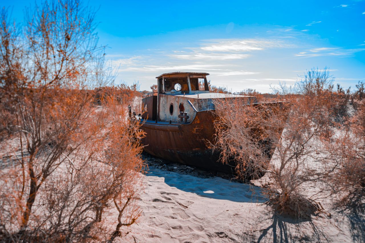
Rusted hulls rest on a cracked, salt-crusted lakebed, a stark reminder of one of the worst man-made environmental disasters of the 20th century.
The Irrigation Plan That Cut Off the Rivers
The transformation began in the 1950s, when Soviet planners drew up a scheme to turn the steppes of Central Asia into the world’s largest cotton-producing region.
To irrigate the fields across the Soviet republics of Uzbekistan, Turkmenistan, and Kazakhstan, Moscow built a canal network stretching thousands of miles.
The project diverted the two rivers that had always fed the lake: the Amu Darya, flowing in from the south, and the Syr Darya, from the north.
The canals were poorly lined, and as much as 70 percent of the water drawn from the rivers seeped into the sand or evaporated before reaching the fields.
With both its rivers cut off, the lake’s level began to fall by 8 to 35 inches a year. Evaporation, sped up by the lake’s shallow depth, far outpaced whatever freshwater still trickled in.
From Fishing Hub to Divided Lake
Within three decades, the falling water level had transformed the lake’s chemistry. By 1980, salinity had climbed from 10 to more than 30 grams per liter — close to that of seawater.
The 20 native fish species that had sustained the regional economy could not survive the rising salinity and disappeared one by one.
The commercial fishing industry, which had employed more than 60,000 people in port cities such as Muynak in Uzbekistan and Aralsk in Kazakhstan, collapsed by the mid-1980s. Ships were left stranded dozens of miles from the retreating shoreline.
By 1989, the lake had shrunk so far that it split in two: the Small Aral in the north, in Kazakhstan, and the Large Aral in the south, in Uzbekistan.
In the early 2000s, the southern lake fractured again into eastern and western basins. In the summer of 2014, NASA satellite imagery confirmed that the eastern basin of the Large Aral had dried up completely.
Toxic Salt Storms and the Toll on Human Health
As the lakebed dried, it exposed a surface saturated with mineral salts, pesticides, and chemical fertilizers that decades of intensive agriculture had washed downstream. Each year, winds sweeping across the Aralkum lift more than 75 million tons of this contaminated dust into the air.
These salt-laden dust storms can travel hundreds of miles, settling over towns and farmland. According to the World Health Organization, Karakalpakstan — Uzbekistan’s autonomous republic along the former southern shore — has seen sharp increases in respiratory illness, esophageal cancer, kidney disease, and anemia.
The disappearance of the lake also reshaped the regional climate. Without the lake to act as a thermal buffer, summers there have grown hotter, winters colder, and both seasons drier.
The Kokaral Dam and the Partial Recovery in the North
What happened next diverged sharply at the border.
In 2005, Kazakhstan completed the Kokaral Dam, an 8-mile dike built with World Bank funding to hold the Syr Darya’s water in the northern basin.
Within a few years, the dam had raised the Small Aral’s water level by about 13 feet and stabilized it. Salinity dropped to levels that aquatic life could tolerate, allowing species such as perch to be reintroduced and small-scale fishing to return to Aralsk.
In the south, Uzbekistan never made restoring the lake a priority. Instead, the government has opened the dried-out bed of the Large Aral to oil and gas exploration.
The Aral Sea today is a divided place: a northern lake that has clawed back some of its aquatic life, and a southern basin where a salt desert has taken the sea’s place.
The ruined fishing ports and stranded ships remain a physical record of what happens when rivers are redirected on an industrial scale.
The Aral Sea basin is one of the starkest examples of the damage that large-scale exploitation of natural resources can cause — and a reminder of just how fragile Central Asia’s vast ecosystems are.